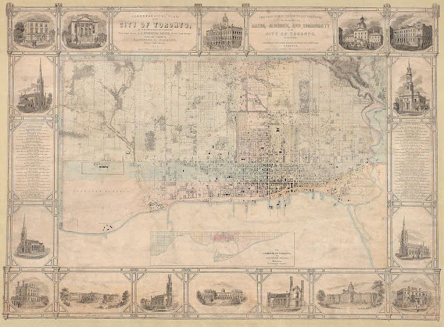
Click map to view a large version. (Note: 5MB)
TOPOGRAPHICAL PLAN OF THE CITY OF TORONTO, IN THE PROVINCE OF CANADA, From actual Survey, by J. STOUGHTON DENNIS, Provin’l. Land Surveyor. Drawn and Compiled by SANDFORD A. FLEMING, Provin’l. Land Surveyor. 1851. // THIS PLAN IS MOST RESPECTFULLY DEDICATED TO THE WORSHIPFUL THE MAYOR, ALDERMEN, AND COMMONALTY OF THE CITY OF TORONTO, BY THE AUTHOR. PUBLISHED BY HUGH SCOBIE, ADELAIDE BUILDINGS, KING STREET EAST. TORONTO. Engraved on Stone by Sandford A. Fleming, Land Surveyor, 67, Yonge St.
Image courtesy Toronto Public Library: T1851/4Mlrg
Winearls, MUC No. 2090
A portrait of Sandford Fleming, ca. 1860:
Sir Sandford Fleming
Image courtesy Library and Archives Canada: C-001164
Next map: 1852 Fleming Verification Plan of the Military Reserves
Back to: The Military Reserve


