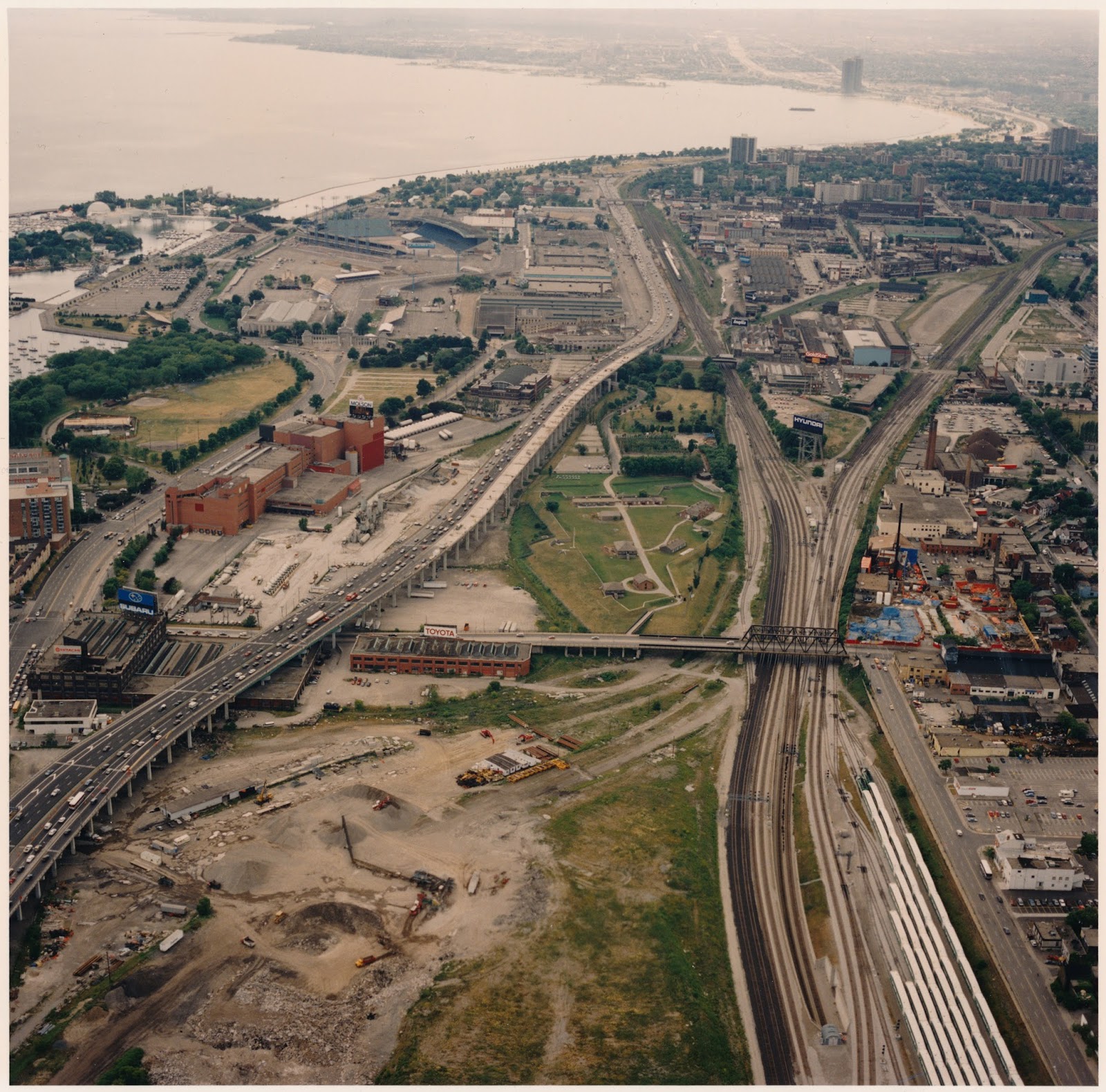
This view of Fort York taken from the CN Tower is what the area looked like in 1994 when the Friends of Fort York, one of the collaborators in this website, was established to advocate the fort’s best interests. In the foreground the lands east of Bathurst still bear the scars of the rail tracks that were there before.
Molson’s Brewery and St. Mary’s Cement dominate the area south of the Gardiner Expressway. Fort York Boulevard had not yet been built, but the heavily-polluted site at 28 Bathurst Street was finally being cleaned up (note the blue plastic tarps).
Click the photo to view a full size version.
Fort York & surrounding neighbourhood, 1994
Photo courtesy of the Waterfront Regeneration Trust, Toronto
Next map: 2012 Stewart: Fort York National Historic Site showing The Encampment
Back to: Aerial Photographs

