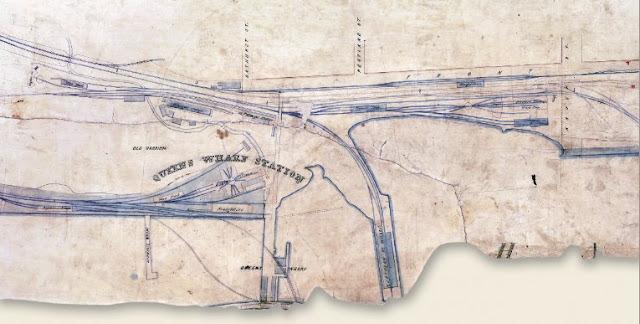
This plan shows what just a few years of railway-building frenzy did to transform the waterfront in the area of the fort. The sector was dominated by the Grand Trunk and Northern (formerly OS&H) Railways. Both constructed extensive yards. But the Northern, which had its southern terminus in Toronto, had also built a massive wharf dominated by a grain elevator. In contrast, the Grand Trunk, priding itself on being a trunk or through line, put up buildings to service its equipment, freight customers and passengers.
Click the map to view a full size version.
[Plan showing the line of the Grand Trunk Railway in the City of Toronto], 1859
Grand Trunk Railway.
Map courtesy Library and Archives Canada: NMC16924
[with retrieval assistance from Derek Hayes]
Next map: 1862 Turner: Sketch of Toronto Harbour
Back to: Wharves and Waterfront

