Click the maps to view in full size.
Plan Clarence Square. Parks Dept. Dec 26, 1923. Revised 1943.
Image courtesy The Planning Partnership & E.R.A. Architects Inc. via their April 2007 report: Heritage Assessment: Clarence Square Landscape Revitalization Strategy
For a history of the ownership of Clarence Square, see this Appendix to the Report by David Spittal (pdf).
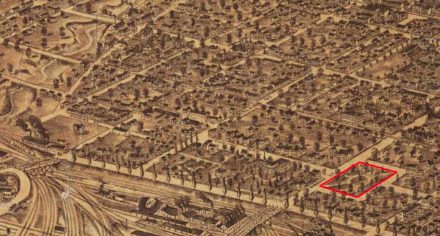
Detail from Bird’s Eye View of Toronto, 1876.
By Peter Alfred Gross.
Image courtesy University of Toronto Map & Data Library: G 3524 .T61 A3 1876
Two points of passing interest — both since demolished — adjacent to Clarence Square:
- The John Gordon house located SE to the Square. Gordon was the president of Grey & Bruce Railway. The house was later inhabited by Sir William Mortimer Clark, Lieutenant-Governor (1903-1905)
- The Hugh Macdonald house, immediately NE of the square. Macdonald was the son of John A. Macdonald.
Next map: 2012 The Planning Partnership: Victoria Memorial Square Update Plan
Back to: East of Garrison Creek

![1923 City Parks Dept: Plan [of] Clarence Square, Toronto 1923 City Parks Dept: Plan [of] Clarence Square, Toronto](https://blogger.googleusercontent.com/img/b/R29vZ2xl/AVvXsEhMpODnQqZjnks8kplK3HGMjGbP5QjruCdeII8l539lQqur9Qq_bBizeGy6_JFxzAXFWI8sAOXDgkG284k1jqXYJEcRAHMs1vVgQwyQYtpXSct_KnqtRyOt43obSGgALxQysVYu14hfYxH0/s640/1923ParkBlueprint-ClarenceSquareSm.jpg)
