[1884, 1894, 1903, 1913, 1924] Goad: Atlas of the City of Toronto, Plate 20

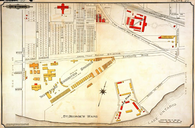
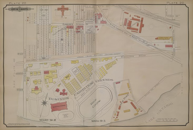
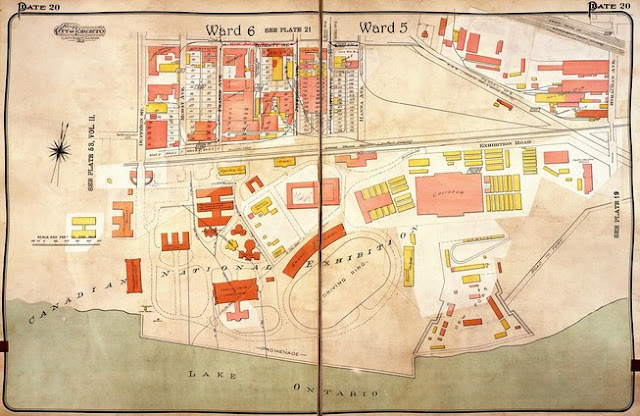
This remarkable series of five maps chronicles the growth of the CNE over four decades. In that time it expanded to fill all the adjacent land and to surround the New Fort (Stanley Barracks) completely. One is struck by the lack of a formal plan for the fairground, except to fill every corner of its site.

Click the maps to view in full-size.

Atlas of the City of Toronto and Vicinity from Special Survey founded on registered plans and showing all building and lot numbers, Plate 20, various editions, by Charles E. Goad, Toronto.

Plate 20, Goad's Atlas of the City of Toronto, 1884

1884. Image courtesy City of Toronto Archives

Plate 20, Goad's Atlas of the City of Toronto, 1894

1894. Image courtesy City of Toronto Archives

Plate 20, Goad's Atlas of the City of Toronto, 1903

1903. Image courtesy Library and Archives Canada: NMC25641

Plate 20, Goad's Atlas of the City of Toronto, 1913

1913. Image courtesy City of Toronto Archives

Plate 20, Goad's Atlas of the City of Toronto, 1924

1924. Image courtesy City of Toronto Archives


Next map: 1889: Exhibition Grounds Birds Eye View
Back to: The Exhibition Grounds