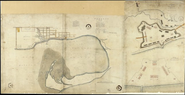
This plan is in three parts: the 'Old' Fort, the New Fort, and where there had been encroachments on the Reserve. Click the map to view a full-size version of the Old Fort detail.
Along the south ramparts of the 'old' fort are the Splinterproof Barracks and Cookhouse, due to be demolished in 1848. Also of interest are some of the privies in the fort since they seldom appear on other site plans. Three are along the lake, and one is behind the “D” Framed Barracks. [read more here, p5] The attempt to show the topography along the lakeshore is interesting.
[Detail from] Toronto, C.W. Sketch shewing the Harbour and Ordnance Property, with the Encroachments on the latter coloured yellow. C.G.G. Lt R.E. 11/7/46 ... J.D. 31/7/46
[Sgd] C.G.G[ray] Lt. R.E. - probably stands for C.G. Gray, a Lieutenant in the Royal Engineers stationed in Canada in 1846
Image courtesy Library and Archives Canada: NMC11444
Winearls, MUC no. 2081
Next map: 1870 Wily: Toronto Old Fort/Toronto New Barracks
Back to: ‘Old’ Fort York

