Like
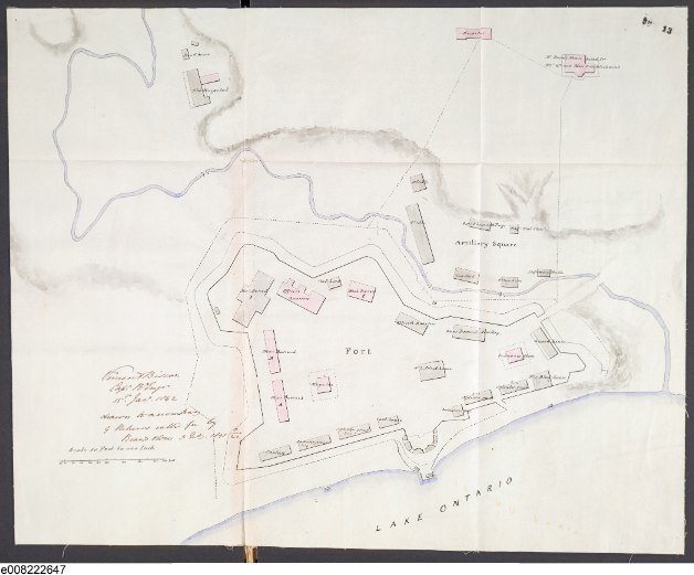
Nicolls’ 1816 plan a quarter century before, which showed Fort York as it was rebuilt in the wake of the War of 1812, Capt. Biscoe's plan reflects construction following Upper Canada's 1838 Rebellion. Most buildings from the earlier cycle remain, but a few such as the Engineer's office have been removed and the long Officers' Barrack flanking the north rampart has been reduced in size. A large new barrack for 350 men has been erected in the northwest corner, another for Artillerymen along the north rampart, and a big cookhouse. Worth remembering is that concurrent with this work the New Fort was being built on the lakeshore, a few hundred yards to the west.
Click the map to view a full-size version.
Fort York in 1842 from a British Army map by Capt. Vincent Biscoe, Royal Engineers.
Image courtesy Library and Archives Canada: C-137340
.
WCE Holloway produced an almost identical version of this map a few years later:
Click the map to view a full size version.
Toronto. Plan of Old Fort, Copied by J A Russell, Captain 93rd Highlanders, Assistant RE, 28 January 1846.
Signed by W C E Holloway, Colonel CRE.
Image courtesy of UK National Archives:
MPH 1/918/2.
Of related interest:
An American Spy's Report on Fort York, 1840
Next map:
1846 Gray: Toronto, C.W. Sketch shewing the Harbour, and Ordnance Property with the Encroachments...
Back to:
‘Old’ Fort York


