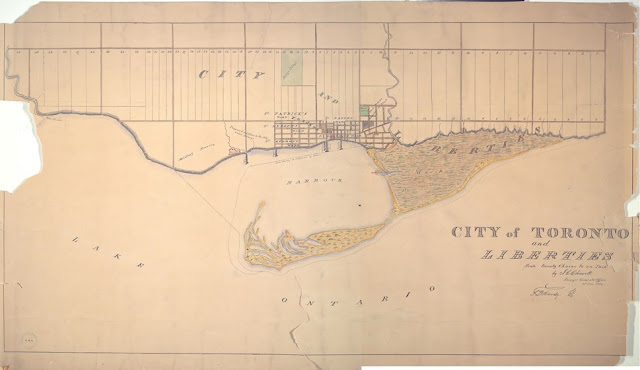
Toronto was incorporated on 6 March 1834, and divided into five wards. Within the city limits liberties or suburbs attached to each ward. The Military Reserve stretches from Peter St. to Dufferin, but the part east of Garrison Creek is noted as being 'under Survey,' i.e. proposed for subdivision. See more [here]. A public wharf, built in 1833 and shortly to be renamed the Queen's Wharf, is shown at the foot of Bathurst Street. The Naval Wharf is just east of Peter Street.
Click the map to view a full size version.
City of Toronto and Liberties by J.G. Chewett
Surveyor Generals Office 24th June 1834 [Sgd] S.P. Hurd S.G.
Image courtesy Toronto Public Library: MsX.1918.1.3
Winearls, MUC No. 2065 (2)
Next map: 1846 Gray: Toronto, C.W. Sketch shewing the Harbour, and Ordnance Property with the Encroachments...
Back to: The Military Reserve

