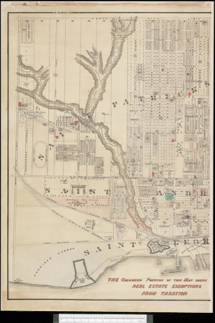
This plan shows where the Agricultural Fairgrounds at Toronto were located from 1858-1878. The new Industrial Exhibition Grounds, now the core of Exhibition Place, were to the south across three rail lines on land marked 'Garrison Common' that wrapped around the New Fort. They were leased from the Government of Canada until 1909, when the title to them was transferred to the City of Toronto.
The area around the Crystal Palace was often frequented by Toronto's prostitutes as they went about their business. This is hardly surprising since it was used only part-time, fringed by clumps of concealing bushes and remote from residential neighbourhoods while being close to the Garrison. See p4 [here] for the efforts of Toronto's local constabulary to keep this problem under control.
Click the map to view a full size version (PDF).
Map of the City of Toronto (with manuscript additions shewing real estate exemptions from taxation, 1878) - Detail
Compiled and drawn by Maurice Gaviller, C.E. & P.L.S., from plans filed in the Registry Office and the most recent surveys, 1872. Wadsworth & Unwin, P.L. Surveyors, Toronto, Sepr. 1st, 1872
Image courtesy Library and Archives Canada: NMC25641
Next map: [1884, 1894, 1903, 1913, 1924] Goad: Atlas of the City of Toronto, Plate 20
Back to: The Exhibition Grounds

