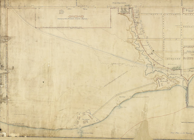
This plan shows the 50-acre parcel on Queen Street granted by the Board of Ordnance to the Asylum Commissioners edged in red. It was opposite Dundas Street (now Ossington Avenue) and the grounds of Trinity College at the head of present-day Strachan Avenue. The Ontario Simcoe & Huron was the sole railway to cross the Reserve in 1852, and its single track touches the corner of the asylum grounds.
Click the map to view a full size version. [View the whole map here (PDF)].
Plan of ordnance lands in the City of Toronto, made from actual survey by S. Fleming, Esqre. in the spring of 1852, under instructions from the Royal Engineers.
Image courtesy Library and Archives Canada: NMC11451
See Fleming’s original version here via LAC: NMC11450
Tangential note: To the east of the Lunatic Asylum, the breweries of John Farr and Thomas Baines [later the West Toronto Brewery] are indicated. Read a short history of the breweries here [p3].
Next map: 1863 Tully: Provincial Lunatic Asylum - Plan of the Grounds
Back to: The Lunatic Asylum

