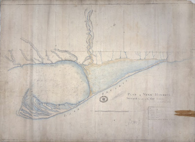
Lieut. Gov. Simcoe made his first visit to Toronto in May, 1793, staying only a few days before going back to Niagara. He did not return again until the end of July, when he and his Queen's Rangers came in earnest to prepare the site of the fort and the town. Meanwhile, surveyor Alexander Aitken had laid out the ground in anticipation. The place was renamed 'York' effective 27 August 1793. Simcoe sent the original of this plan to the Home Secretary, the Hon. Henry Dundas, on 20 Sept. 1793, soon after York was founded. North of the Reserve, along Lot [Queen] Street, lay the Park Lots that Simcoe granted to thirty-five privileged individuals starting in early September, 1793.
Click the map to view a full size version (3MB).
Plan of York Harbour Surveyed by order of Lt Govr Simcoe [Sgd] by A[lexander] Aitken D [Syr?], 1793.
Image courtesy The National Archives of the UK: CO 700 Canada no. 60
Winearls, MUC no. 2015
[Digitized via the generous support of Angie & Jeff Hocking]
Next map: 1813 Williams: Sketch of the ground in advance of and including York, Upper Canada.
Back to: The Military Reserve

